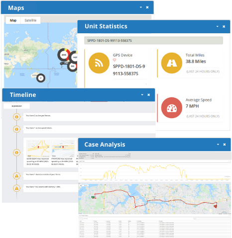
Vehicle Tracking System
Our Vehicle Tracking Application is designed to meet the needs of government and law enforcement. Stop using cookie cutter Vehicle Tracking Systems that aren't built for the needs of today's high-performing agencies. Read more about the product and features below:

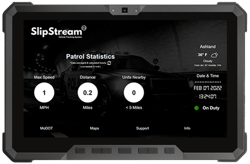
Vehicle Tracking Systems engineered to fit the operating environment of law enforcement
Our SlipStream Vehicle Tracking Application, provides both operator & agency the total visibility needed to monitor and coordinate field assist in real-time. This purpose built application, connects the in car interface directly with the backed location tracking and mapping. The feature set and functionality was design to solve the problems that other Vehicle Tracking fail to address as it relates to law enforcement based asset management.


Key Features
Our GPS Tracking App for Public Safety isn't your everyday tracking application. AppTrac is a purpose-built mobile utility designed for public safety, asset visibility, and real-time information streaming.
In-Car Statistics
View driving statistics, traffic, and speed right from your vehicle mounted MDT.
Geofence Zones
Utilize Geo Zones and Funnels to detect outside boundary movements.
Custom Alerts
Setup custom alerts like speed, battery, and Geo Zone crossing.
Reporting & Analytics
Access real-time reports and statistics to analyze location and asset movements.
Rapid Update Interval
Get timely location reporting and tracking on live field assets every 10 seconds.
Mobile Optimized
Access real-time mapping from any in car device with an internet connection.